
Start a Springfield Street Directory Search
A street-by-street search should move from the precise address outward, not from a guessed household name. Springfield's assessor and GIS provide the address-to-parcel bridge. The tax and Registry records can identify a tax or deed party, while older directories preserve dated address entries. Voter information follows a separate, protected access route. This sequence keeps a current parcel record, an ownership record, and a historical address listing from being treated as the same fact.
- Enter the house address in the assessor search, choose the popup match, and note the parcel identifier, street address, and assessment date.
- Search the same road in City Web GIS. Use the parcel outline and available property-card link to keep each address connected to its parcel.
- Use the separate tax route when an owner-name, tax-bill, or mailing clue is needed. Keep the mailing line distinct from the parcel location.
- Search the Hampden Registry by address or recorded party for a transfer. Record the grantor, grantee, instrument, date, book/page or document number, and legal description.
- For dated people evidence, compare city-directory years or use a lawful Elections Office request. Neither source is a complete current household list.
This method is for an address trail. It does not turn a street name into proof of every person who may be associated with that road.
Springfield Street Directory Assessor Fields
The assessor is the cleanest first stop for a Springfield address. It accepts a parcel number or a street entry, and a street name alone can browse all listed addresses on that road. The user must choose the correct autocomplete suggestion. Results can then sort by street number or owner name. The page is not an owner-name search form, even though its results can be sorted by owner.
The City assessor search displays the parcel and street controls used for this first address check.
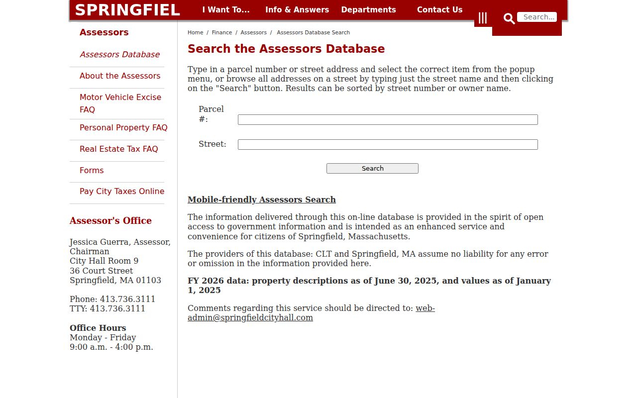
The City identifies its FY2026 property descriptions as of June 30, 2025, while values are as of January 1, 2025. That timing matters. A parcel card is a dated assessment record, not a live list of people at an address.
| Assessor control | Type | Required | Street-search use |
|---|---|---|---|
| Parcel # | Text | Optional | Enter a known parcel number, then choose its popup item |
| Street | Text with autocomplete | Optional | Enter a full address or a street name alone for a street browse |
| Popup selection | Autocomplete list | Practical requirement | Select the correct street or parcel after typing |
| Search | Button | Not applicable | Runs the requested address or street search |
| Sort | Result control | Optional | Sort listed results by street number or owner name |
| Mobile-friendly search | Link | Not applicable | Alternate presentation supplied by the assessor |
Springfield Street Directory Record Chain
No one database answers every street question. Each record set has a different key, date, and limit. A parcel ID joins the assessor and GIS views; an address or legal description can bridge to a Registry instrument; a published directory creates a dated address observation. The records below are useful in sequence because each one corrects a different overreach from the others.
| Record Set | Keeper | What It Shows | Access |
|---|---|---|---|
| Assessor parcel | Springfield Assessors | Owner clue, situs, value, parcel, and street browse | Free address or parcel portal; no owner-name field |
| Tax and property card | City Finance | Tax-bill owner, mailing distinction, property card, history, and lien clues | Free owner, street, parcel, and bill routes |
| City GIS | Springfield GIS | Parcel geometry, owner/PID detail, building and district layers | Free map with property-card bridge |
| Deed index | Hampden Registry | Grantor, grantee, date, book/page or instrument, and legal description | Free online; different pre-1948 workflow |
| Building or code file | Code Enforcement / OpenGov | Public permits, inspections, violations, and responsible-party clues | Public portal; exact live fields not documented |
| City directory | Springfield City Library | Historical person, business, occupation, and street-number snapshot | Library or scanned collection; local run 1866-1989 |
| Atlas or Sanborn material | Library and preservation resources | Structure, lot, use, and selected owner-label context | Library access; exact Springfield Sanborn years not located |
| Voter record | City Elections / Commonwealth | Registration and address fields subject to law and protection | Individual status route or local-office request |
A street name does not always remain stable enough to be the only key. Preserve the house number, parcel ID, date, and legal description where available. The property chain may continue under a former number, an entity name, a trust, or a deed description instead of the street wording used today.
Springfield Address Terms That Matter
The same property can carry several addresses in public records. Mixing them creates false matches. The assessor and GIS connect the first two concepts to a parcel ID, while the Registry is the authority for the description used to convey the land. A city-directory entry is a publication snapshot, not a substitute for any of those records.
- Parcel
- A mapped unit of land tied to an assessor or GIS identifier.
- Situs address
- The physical place where the parcel or building is located.
- Mailing address
- The line used for tax-bill or owner correspondence, which may be elsewhere.
- Legal description
- The deed's lot, plan, boundary, or certificate wording, which can survive a street-number change.
- Plat or plan reference
- A mapped lot document cited in a legal description where the record uses a plan reference.
- Criss-cross directory
- A reverse address tool that can connect a street number to a past published entry; exact Springfield reverse-volume years were not located.
Note: Treat an out-of-city mailing line as a tax correspondence clue, not proof that a person presently uses or occupies the Springfield parcel.
Springfield Street Directory Map Layers
City Web GIS is the practical map authority for a road search. Enter an address or street, accept an exact or closest match, select the parcel, and use View Details. Its parcel detail can display street address, owner, parcel ID, land area, and assessed-value concepts, then link to a property card. The viewer shows parcels and geographic context, not a person-by-person roster.
The Springfield Web GIS includes street, parcel, neighborhood, ZIP, zoning, district, and aerial layers that explain why the same road can be described differently by different records.

Parcel Outlines, Building Outlines, Address Numbers, Parcel Lot Number, Parcel Dimensions, Street Names, ZIP Codes, Neighborhoods, historic districts, election wards and precincts, inspector zones, wetlands, and common-ownership parcels can be toggled independently. The available aerial layers include 2025 imagery captured in March 2025, plus 2020 and 2013 imagery. Those layers do not share one boundary system, so record which layer supplied each conclusion.
Springfield Street Directory Tax Route
The tax-information portal is the owner-name route that the assessor page is not. It accepts a tax-bill name last name first without a comma, a last name alone, or a percent sign as a wildcard. Street terms should use the tax-bill abbreviation, such as ST. A partial term can match more than one Springfield road, so compare the returned address and parcel before treating a result as a match.
The City tax-information search provides the owner, street, and property-card entry point for a second check after the assessor result.
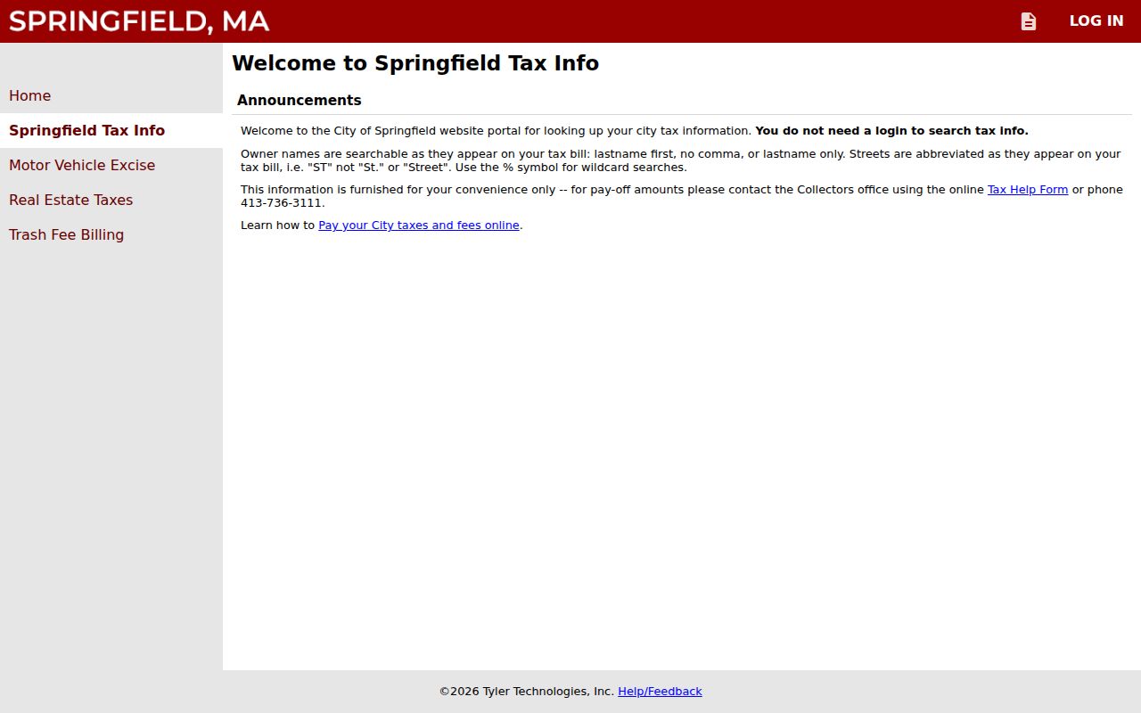
The tax-title route separately accepts Owner, Parcel Number, and Street, with owner, street, street-parcel, and bill-number browsing. The Collector/Treasurer route supplies real-estate tax history back to 2004. A tax record can identify a tax party or lien trail, but a tax-bill mailing address remains different from the property situs.
Springfield Street Directory Deed Trail
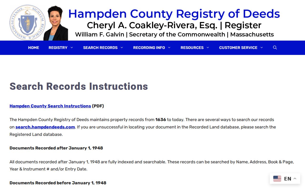
The Hampden Registry gives the property transfer layer behind a street address. Its collection statement reaches from 1636 to today. For recorded documents after January 1, 1948, the online index supports Name, Address, Book & Page, Year and Instrument Number, and Entry Date. Search the property address and recorded parties, then open the instrument rather than relying only on a result line.
A deed search records the grantor, grantee, instrument type, recording date, book/page or document number, legal description, and linked prior-deed reference where shown. A person or organization can be an indexed party without being a current occupant of the parcel. Deed copies are free online through the Registry; certified paper copies are $1 per page in person or by mail.
Pre-1948 Springfield Street Records
Older recorded land takes a different path. Start with Recorded Land and only move to Registered Land when needed. For a document before 1948, choose Grantor or Grantee, search the surname with optional start and end years, inspect the scanned index book, extract the book and page, then return to Book & Page for the instrument image. That index method is a useful answer when an older address search returns nothing.
The Registry's search instructions document the pre-1948 Grantor/Grantee and Book & Page workflow.
Registered Land and Land Court materials use certificate-of-title and document numbers instead of an ordinary book/page reference. Land Court documents, indices, images, certificates, and plans are online from 1899 to the present, but certificate and plan questions may require Registry help. Springfield's municipality code is SPD in the Registry instructions.
Springfield Street Directory Voter Limits
The Massachusetts status form is not a street browser. It requires a person's first name, last name, date of birth, and the ZIP where that person is qualified to vote, followed by agreement to the form statement. A lawful local voter list can have address and registration fields, but the statewide list is not public for unrestricted distribution. Phone, email, veteran status, permanent-absentee status, confidential-voter information, and minor or pre-registrant information are withheld.
For a complete Springfield municipal file, direct the request to the Elections Office as custodian and describe the year, municipality, precinct or ward, street-list category, requested format, and whether the request is complete or limited. Research did not locate a City request form, fixed fee, delivery format, or processing time. The annual street listing is dated as of January 1 and is not a freely searchable household database.
Springfield Street Directory Number Changes
Street numbers need historical context. Springfield Museums documents that 391-395 Main became 1379 Main after a Main Street renumbering in the 1920s. A search limited to the newer number can miss earlier material, and an old-number search can miss the later record trail. Pair both numbers with a business or person name, a city directory, an atlas, and the deed's legal description.
City Chapter 143 assigns address numbering to the Director of Public Works. Numbers run continuously from one end of a street, with odd numbers generally on the southerly or easterly side and even numbers on the northerly or westerly side where practical. Renumbering requires Mayor and City Council action. Current numbering helps organize a search, but it does not make an historical number a permanent key.
Limits of a Springfield Street Directory
Street records have firm privacy boundaries. A parcel map does not list every person inside a building. Non-owner occupants, household composition, utility customer information, and motor-vehicle addresses are not public street-directory material. Protected voter addresses, restricted court and vital records, and certain public-employee home information require the same restraint. Do not try to reconstruct a protected address from separate records.
OpenGov permits and code cases can add construction, alteration, inspection, or demolition dates, but their named applicant or owner may not be the current occupant. The public lookup does not require sign-in, yet its exact search fields, result columns, start date, page size, and export controls were not documented in the reviewed source. For a needed non-exempt file, request a specific address, year, and record type through the appropriate City channel.
Lawful use. Use Springfield street and address records for personal history, civic context, or reconnecting with care. Never use a lookup to watch, contact, harass, or intimidate anyone; stop at protected data and ask the custodian only for a non-exempt record.